
Photo essay
By Jeremy Roger Marentette
The Front Cover
The front cover of the collection consists of two photographs taken on the campus of York University, Toronto, at dusk. They are not copies of the same image. Each was taken at two separate moments of time with slightly different levels of exposure. My goal is to evoke a feeling of balance and symmetry through repetition while visually representing the notion of change.
The Contents
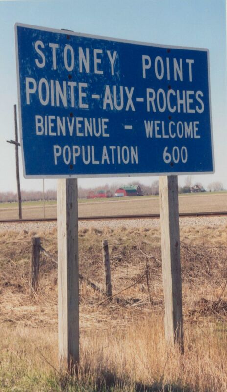
The story begins in Stoney Point, Ontario, a small community on the southern shore of Lake St. Clair. There are only five ways to enter or leave Stoney Point, six if you count the lake. One route, Highway 77, leads past a massive granary that serves as a depot and distributor of agricultural products produced by local farmers. Highway 77 runs north of Essex County to Leamington in the south. Lake St. Clair to Lake Eerie in thirty minutes.
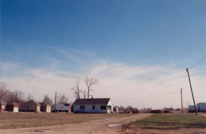
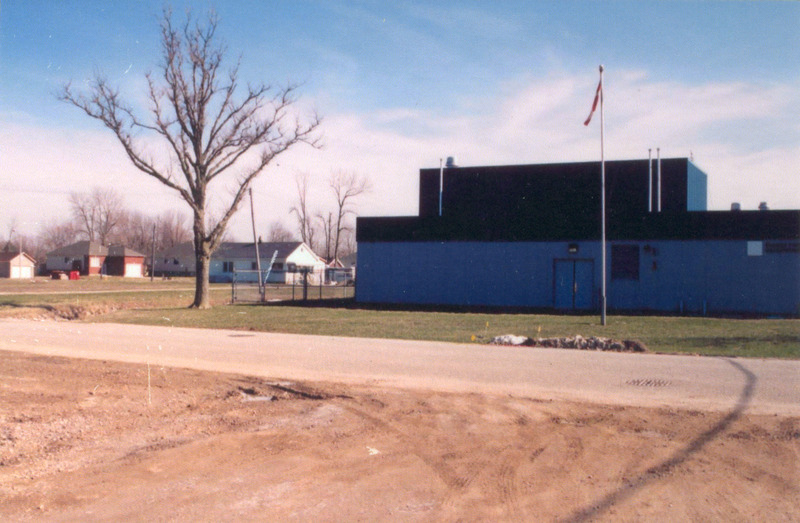
Take 77 north as far as you go, turn west and go about 500 metres. On the south side of the road, away from the lake, is a small cottage set far back on a massive lot. It was owned by Raymond Knister’s uncle, John Goatbe, and it is the same cottage that Raymond rented on the weekend of August 29, 1932. The property communicates a feeling of nostalgic claustrophobia. Enveloped by a maze of pre-fabricated homes and subdivided farmland, the cottage that once provided an escape from city and small-town life has now become part of the town. A public works building now stands adjacent to the property, accommodating the municipal expansion that is cannibalizing this cultural landmark.

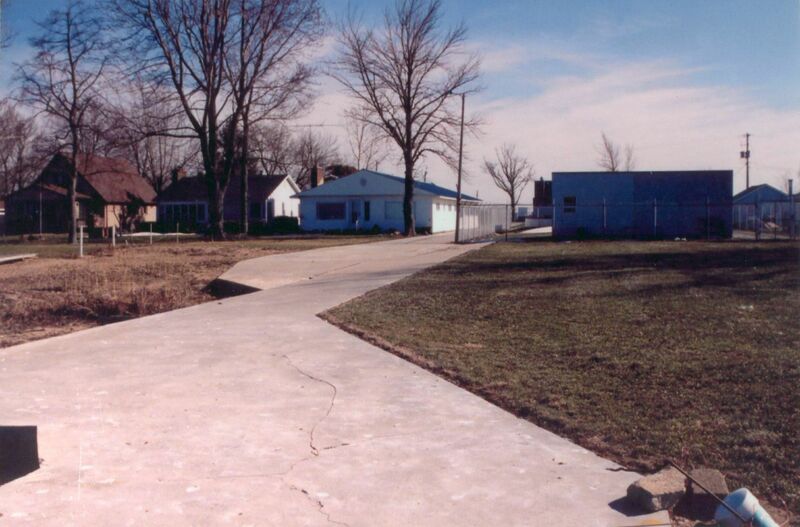
The land across the road from the utility and the cottage was once a grassy pedestrian thoroughfare to the beach. Now there is a fenced pumping station and a house with a concrete pathway. Between the two is a concrete pathway that spans the distance from road to lake. It is this public space that was used by vacationers and locals who did not have a private alternative.
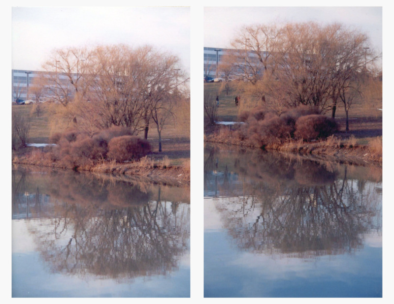
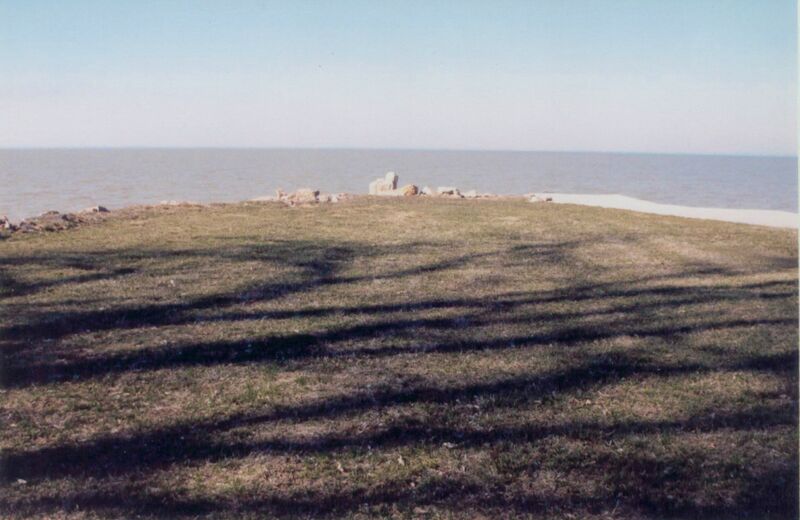
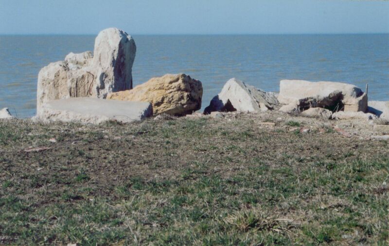
The sandy beach is now the foundation for limestone boulders. These boulders contain a nicely manicured lawn that extends into the lake much further than the private beaches on either side, offering an exceptional vantage point from which to view the shoreline and the lake. This is the place where Raymond Knister pushed his boat into the water for his final swim. This is the place where Raymond’s wife entreated him to return to shore. This is the place where she stood in terror as he disappeared under the murky water forever.
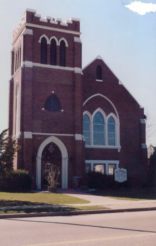
Some biographies of Raymond record that a funeral wake was held for him at St. Andrew’s United Church in Comber. The church is on the west side of Highway 77 in the middle of town, not even a ten minute drive from Stoney Point. One block south of the church is where Highway 77 intersects the formerly named Highway 98, now called County Road 46.
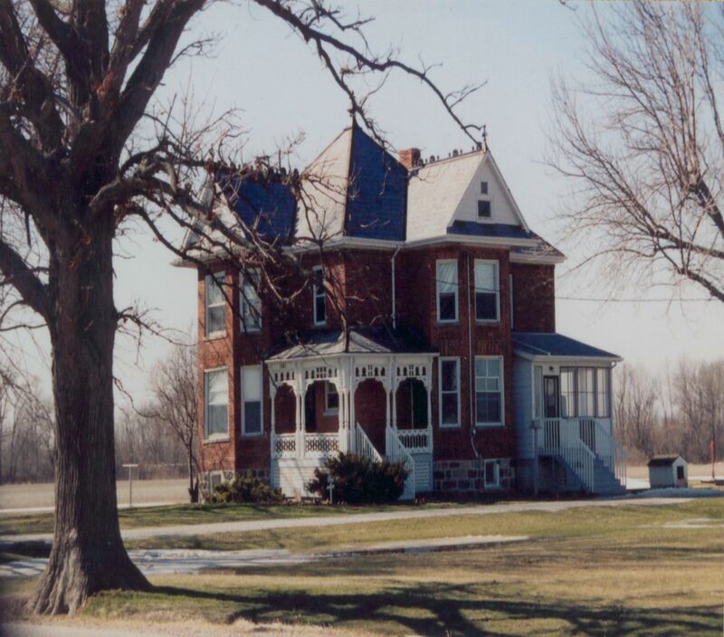
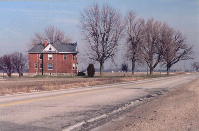
Approximately five kilometers west on 46 is the former house of Dr. Knister. The house is two storeys of intricately laid red brick with a Victorian flair capitulated by metal spires that follow the peak of the roof from front to back, giving it the appearance of a black metallic spine.
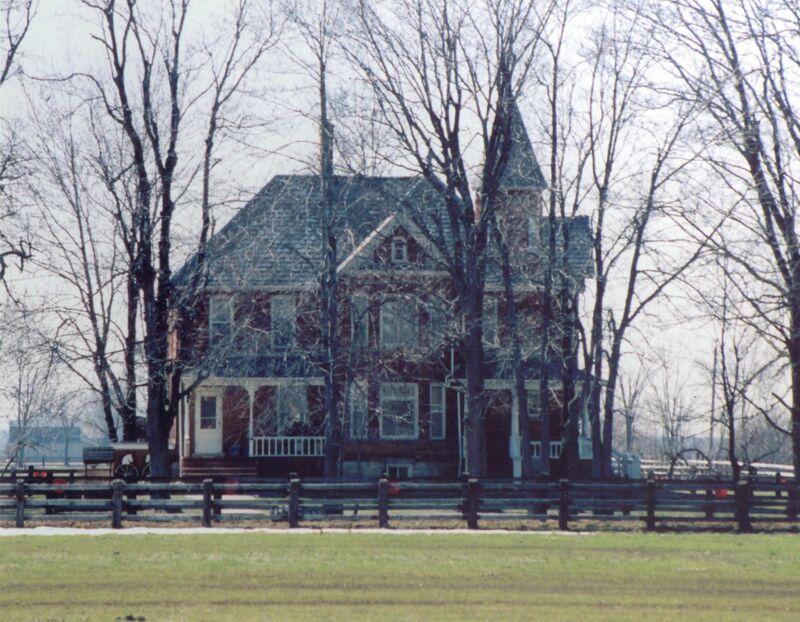
Further up the road is a bridge over the Ruscom River and a railway crossing. Beyond the crossing on the west side is a large green pasture surrounded by a beautiful wooden fence. The pasture separates the road from the massive mansion that was built by Raymond’s uncle John Knister at the turn of the 20th century. Its size is impressive. Its aura is mysterious and spooky. Local children told stories of a young girl that could be seen looking down from a window in the turret on the third storey of the home. The property has changed ownership several times over the past century but the present owners still actively farm the land.
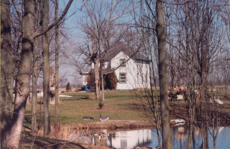
Directly across the road is a vast open field that once bragged a huge wooden barn. The barn burned to the ground in the early 1980s, long after it served as a respite for farming implements and beasts of burden, and as a playground for children who grew up on nearby farms. About two hundred metres east of the homestead on County Road 46 there is a minor road, not easily discernible from the land that surrounds it, which leads north in proximity to the Ruscom River. Not far down the road a white home becomes visible on the east side. It is set back from the road beyond a small pond. It was another Knister home years ago.
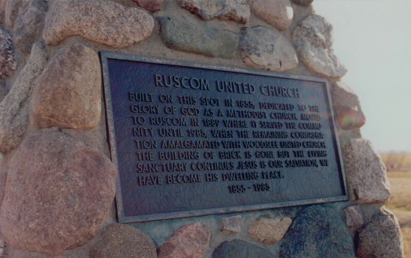
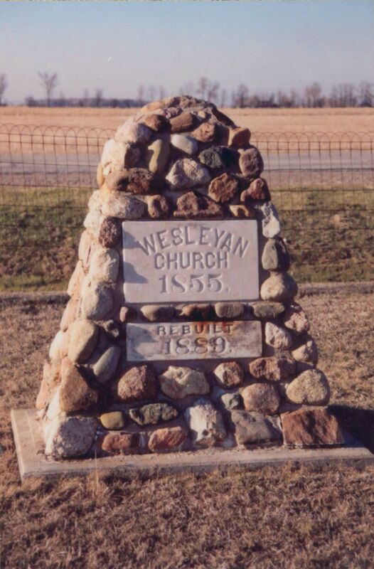
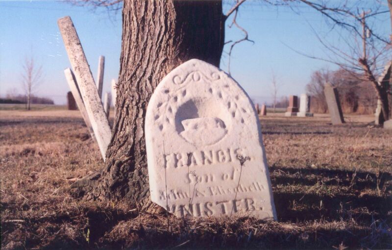
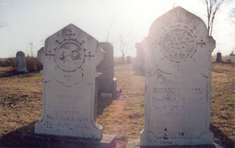
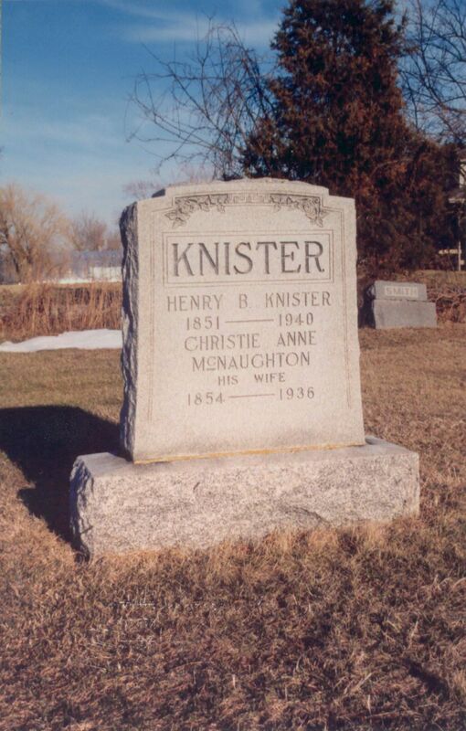
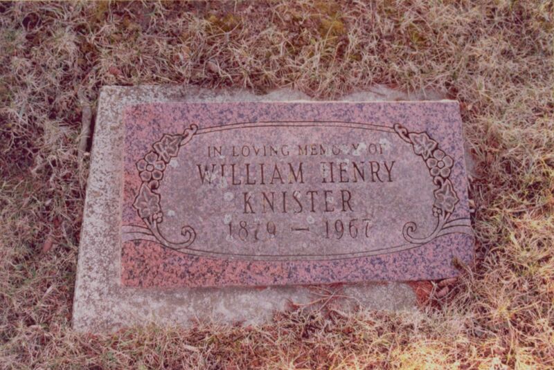
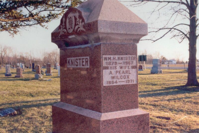
There were a lot of Knisters in this area during and after Raymond’s lifetime. All of them come from the same family of people who moved to Ruscom in the latter portion of the 19th century. They were a Methodist clan with very strong ties to the land and to their community. Even today, many local people fondly recall “old Doc Knister” who practiced in Comber for decades. There was William H. Knister, who served the public as County Road Superintendent in the 1920s. And then, of course there was Raymond...
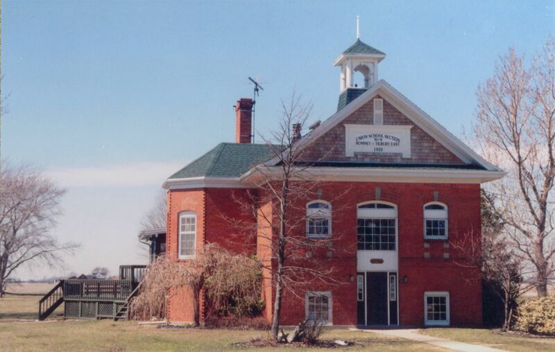
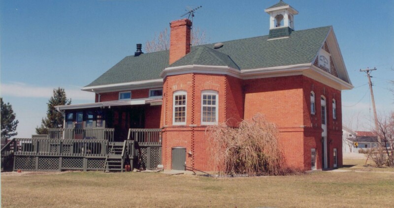
The Stevenson Schoolhouse
The last few photographs in the collection were taken in Stevenson, Ontario on Friday, April 11, 2003. The Stevenson Schoolhouse is about ten kilometres south of Tilbury on Kent Road 5. The road winds, twists, bends and curves until it converges with three other roads at an awkward intersection. There is a church, three homes and the schoolhouse. The schoolhouse has been converted into a dwelling. The owners are a pleasant couple and seemed eager to talk about the building, in part because of the fact that the schoolhouse is for sale, but also because they truly embodied the friendliness and hospitality that one stereotypically expects of people in rural communities. The sign on the front of the building is original.